


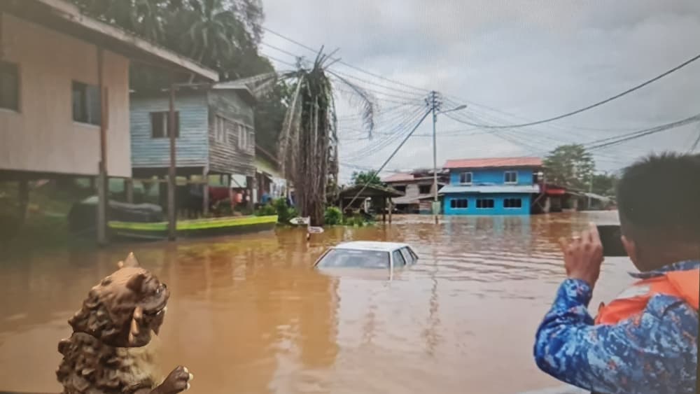
With urban areas increasingly unable to absorb heavy rainfall, continued construction in vulnerable zones could worsen flooding. Integrating IoT-based flood detection systems can provide real-time monitoring and early warnings, helping communities and infrastructure stay ahead of rising flood risks.
Geotechnical risks in floods
Floods are among the most destructive natural disasters, threatening lives and critical geostructures like slopes, embankments, dams and bridge foundations. Even minor soil movement, seepage or stress can trigger catastrophic failures, from collapsing slopes to breached embankments and undermined bridges, magnifying damage to surrounding communities. Traditional monitoring, i.e. manual gauges, periodic inspections and static barriers, often misses early warning signs, leaving dangerous gaps. Understanding these geotechnical risks is crucial for anticipating failures and protecting both infrastructure and people, setting the stage for innovative approaches to flood resilience.
Sleuthing beneath the surface
Today, the integration of the Internet of Things (IoT) and Artificial Intelligence (AI) is transforming disaster management. Dense networks of sensors can now track real-time water levels, soil moisture and structural performance, feeding data into predictive models that anticipate potential failures. By linking IoT flood detection systems with geotechnical monitoring, engineers can identify warning signs before disaster strikes. Early alerts enable timely interventions, such as reinforcing embankments, adjusting drainage systems or temporarily closing vulnerable areas, mitigating both human and infrastructural losses. Ultimately, smart flood detection represents a convergence of geotechnical expertise and digital innovation, continuously safeguarding communities and the resilience of vital infrastructure against an increasingly unpredictable climate.
Sensors in the ground
Rapid increases in soil moisture during heavy rainfall are a key trigger for slope failures and landslides, as rising pore water pressure weakens the soil’s shear strength. IoT early warning systems address this risk by integrating soil moisture sensors that measure groundwater saturation continuously. This streaming data provides predictive indicators, enabling engineers to assess flood and slope stability risks well before surface flooding or slope failure occurs. Beyond surface monitoring, Wireless Underground Sensor Networks (WUSNs) can be deployed to track pressure, temperature, and vibration below ground. This subsurface visibility offers real-time observation of groundwater behaviour without constant manual drilling or delayed testing. Together, these technologies give geotechnical engineers a proactive toolset to safeguard slopes, embankments and critical infrastructure against water-induced failures.
Monitoring the frontline
Earthen dams and embankments are particularly vulnerable to breaches when water levels rise unexpectedly or internal seepage develops. Modern IoT systems provide node-level monitoring across rivers, dams, drains and coastal areas, enabling site-specific thresholds and localized risk assessments. By integrating ultrasonic sensors for non-contact water level measurements with specialized pressure sensors that detect variations in water force against structures, these systems give engineers precise, continuous insights. When combined with flow rate meters and rain gauges, geotechnical professionals gain a comprehensive, real-time understanding of the hydrological loads acting on an embankment, allowing for timely interventions that safeguard both infrastructure and downstream communities.
Sentinels for structural health
Geotechnical infrastructure, including bridge foundations, retaining walls and other earth-retaining structures, is constantly subjected to dynamic loads from environmental forces and human activity. The concept of the “Digital Twin”, a precise digital replica of a physical structure, offers a powerful solution for monitoring such assets. Networks of triaxial accelerometers can be installed along these structures to capture vibration data in real time. Cloud computing and advanced deep learning algorithms, such as 1-D Convolutional Neural Networks, process this data to detect changes in stiffness or early signs of structural damage with remarkable accuracy. By predicting future behaviour, engineers can plan proactive maintenance and interventions, reducing the risk of catastrophic failure and enhancing the long-term resilience of critical geotechnical infrastructure.
AI on the high grounds
Slope stability is a critical concern in mountainous and topographically complex terrains, where intense rainfall can quickly trigger landslides or flash floods. In these environments, geotechnical risk is closely linked to changing hydrological and soil conditions. By integrating IoT sensor networks with advanced machine learning models, engineers can shift from reactive monitoring to predictive forecasting. Algorithms such as Random Forest (RF) and Long Short-Term Memory (LSTM) networks effectively process complex time-series data, including continuous rainfall, groundwater fluctuations and soil moisture variations. Trained on real-time sensor inputs, these models can forecast impending instability with high precision. In predictive applications, Random Forest models have achieved up to 98.7% accuracy in water-level forecasting, giving engineers and authorities valuable lead time to implement preventive measures and reduce disaster risk in vulnerable hilly regions.
Smart systems, harsh realities
While IoT-driven monitoring offers transformative benefits, deploying these systems in geotechnical environments presents major challenges. Sensors on exposed slopes, river channels or remote catchments must withstand extreme weather, debris, measurement noise, power limits and potential hardware failure, any of which can trigger false alarms or data gaps. Large-scale deployments across dams or hilly terrains demand significant investment, and without strategic planning, dense networks risk redundancy and data overload. Connectivity and power constraints in remote areas further complicate real-time transmission, requiring low-power wide-area networks and solar systems capable of enduring prolonged storms. These realities highlight that, while smart monitoring improves predictive stability, its effectiveness depends on robust engineering, careful deployment and sustainable support.
Therefore, the integration of IoT and AI into geotechnical and flood monitoring shifts management from uncertainty to informed control. By combining smart sensors, predictive analytics and digital modelling, engineers can move from reacting to failures to preventing them. Despite technical challenges, this convergence of engineering and intelligent technology is redefining resilience, enabling professionals to safeguard infrastructure, communities and lives amid escalating climate risks.
The future of flood resilience is not just built on concrete and soil, it is indeed powered by data, foresight and smart engineering.

Prof. Ir. Dr. Chan Chee Ming
Faculty of Engineering Technology
Principal Researcher
Research Centre for Soft Soils (RECESS)
Universiti Tun Hussein Onn Malaysia
