THE STAR 15 October 2022 :
KUALA LUMPUR: More locations across the country are now at risk of floods during the transition to the northeast monsoon at the end of the year.
Several areas on the west coast of the peninsula which had escaped the wrath of monsoons in the past are not being spared now. Malaysia is currently transitioning from the southwest monsoon phase while the northeast monsoon will set in next month and last until March.
The Malaysian Meteorological Department (MetMalaysia) and climatologists have forecast abovenormal rainfall across the country this year and expect more locations – previously unaffected by floods – to turn into flood hotspots.
“In fact, even now during the transition period, floods are already occurring more frequently nationwide,” MetMalaysia deputy director-general (Strategic and Technical) Dr Mohd Hisham Mohd Anip was quoted as saying at the National Climate Forum, held here last week.
The Irrigation and Drainage Department (DID) has identified 5,496 locations nationwide as floodrisk areas, with 761 of them on the peninsula’s west coast.
The use of sophisticated technology enables MetMalaysia and DID to make weather forecasts with a high degree of accuracy, comparable to that of advanced countries.
This allows authorities to issue flood warnings and make preparations in advance to mitigate the impact of the floods.
Universiti Tun Hussein Onn Malaysia technologist Dr Muhammad Rusydi Muhammad Razif, however, felt the current adaptation of technology in disaster management was not being done in a comprehensive and integrated manner, particularly in rescue efforts involving victims affected by floods and other natural disasters.
According to him, Industrial Revolution 4.0 (IR4.0) technology was not being optimised in rescue efforts, adding that these operations could be carried out more efficiently through the use of the Internet of Things (IOT) technology, one of the backbones of IR4.0.
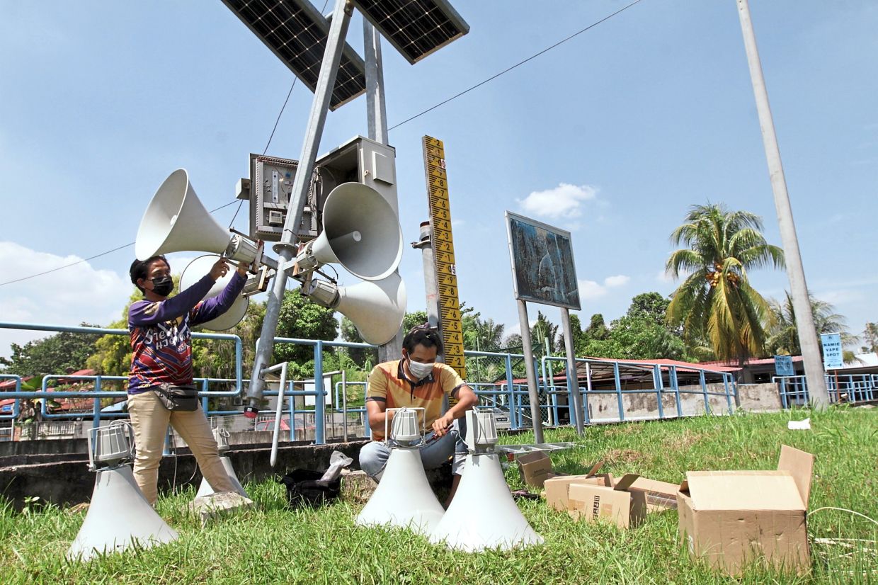
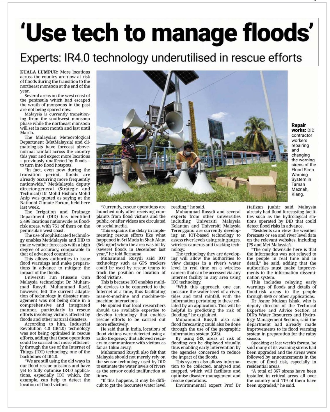
“We are still using the old ways in our flood rescue missions and have yet to fully optimise IR4.0 applications, especially IOT which, for example, can help to detect the location of flood victims. Repair works: DID contractor workers repairing and changing the warning sirens of the Flood Siren Warning System in Taman Maznah, Klang.
“Currently, rescue operations are launched only after receiving complaints from flood victims and the public, or after videos are circulated on social media.
‘This explains the delay in implementing rescue efforts like what happened in Sri Muda in Shah Alam (Selangor) when the area was hit by (severe) floods in December last year,” he told Bernama.
Muhammad Rusydi said IOT technology such as GPS trackers could be used by rescue teams to track the position or location of flood victims.
This is because IOT enables multiple devices to be connected to the Internet at a time, thus facilitating man-to-machine and machine-tomachine interactions.
He opined that local researchers should use available expertise to develop technology that enables rescue efforts to be carried out more effectively.
He said that in India, locations of flood victims were detected using a radio frequency that allowed rescuers to communicate with victims as far as 15km away.
Muhammad Rusydi also felt that Malaysia should not merely rely on the sensor technology used by DID to estimate the water levels of rivers as the sensor could malfunction at times.
“If this happens, it may be difficult to get the (accurate) water level reading,” he said.
Muhammad Rusydi and several experts from other universities including Universiti Malaysia Kelantan and Universiti Malaysia Terengganu are currently developing an IOT-based technology to assess river levels using rain gauges, wireless cameras and tracking technology.
The technology they are developing will allow the authorities to view changes in a river’s water level in real time on a wireless camera that can be accessed via any Internet facility in any area using IOT technology.
“With this approach, one can measure the water level of a river, tides and total rainfall, with the information pertaining to these collated by an application. This will be helpful in predicting the risk of flooding,” he explained.
Muhammad Rusydi also said flood forecasting could also be done through the use of the geographic information system (GIS).
By using GIS, areas at risk of flooding can be displayed visually, thus enabling early intervention by the agencies concerned to reduce the impact of the floods.
This system also allows information to be collected, analysed and mapped, which will facilitate and optimise disaster management and rescue operations.
Environmental expert Prof Dr Hafizan Juahir said Malaysia already had flood forecasting facilities such as the hydrological stations operated by DID that could detect flood risks in advance.
“Residents can view the weather forecasts or sea and river level data on the relevant websites, including JPS and Met Malaysia’s.
“The only downside here is that the information was not relayed to the people in real time and in detail,” he said, adding that the authorities must make improvements to the information dissemination system.
This includes relaying early warnings of floods and details of flood-risk areas to the people through SMS or other applications.
Dr Asnor Muizan Ishak, who is deputy director of the Technical Expertise and Advice Section at DID’s Water Resources and Hydrology Management Section, said the department had already made improvements to its flood warning system in preparation for the rainy season.
Speaking at last week’s forum, he said many of its warning sirens had been upgraded and the sirens were followed by announcements in the event of flood risk, especially in residential areas.
“A total of 367 sirens have been installed in critical areas all over the country and 119 of them have been upgraded,” he said.
This news also published in :
1. thestar.com, 15 October 2022 : https://www.thestar.com.my/news/nation/2022/10/15/use-tech-to-manage-floods
2. kualalumpurgrid.com, 15 October 2022 : https://kualalumpurgrid.com/en/news/article/13003263/use-tech-to-manage-floods